A Sunday morning cycle on the Barrow Way alway throws up something new and interesting!
This morning was just my third cycle since January 29th and was 20kms out and back to Maganey. Sunday morning is always a nice time to be on the River and I like nothing better than to keep a sharp eye out for what Mother Nature has in store.
Today it was Mink near Maganey Lock, the elusive black coated mammal loves to frolic along the river bank but is too fast to get the camera out!
On the way back into Carlow Town I came across a Dragon Boat Race. What a spectacle!
And another win for the Carlow crew!
Dragon Boat Race. Three all women crews racing to the beating of drums! A great sight.
We leave tracks wherever we walk. For thousands of years man has followed rivers inland, forging new paths, seeking shelter, food, searching for places never visited before.
In whose footsteps do we wander when we thread The Barrow Way?
We have few wild places remaining which is why The Barrow Way is so special in today’s fast paced world.
Columbanus travelled this way on his journey to Cleenish Island in Fermanagh where he began his education before his onward journey to Bangor in County Down. It’s ironic that now the we are trying to create Turas Columbanus or the Columban Way, (which will follow the Barrow Way to Monasterevin), we are again talking about developing the Blueway Cycle Path. We need clarity about what we intend to do with the Barrow Track. It cannot be a long distance walking trail and a cycling path. Surely it’s one or the other?
Countless people working on the barge traffic that serviced industry and agriculture were very familiar with this route once the canal network was created. It was a lot busier in the 19th Century than it is today!
Today it is designated a Special Area of Conservation. Or at least it was.
Tracks and Trails..The longest continuous off-road walking route in Ireland is again under threat….
Proposals are due to come before the Local Authority to revisit the Barrow Blueway decision. The Blueway, specifically the replacement of the grass surface with a hardcore surface to facilitate cycling, put forward by Waterways Ireland a few short years ago was refused by An Bórd Pleanála following an unprecedented level of local objections to the proposal. I sincerely hope the proposal will not reverse the decision to remove the grassy path.
The grassy towpath, soft underfoot, a pleasure to walk on.
Unfortunately it appears that the views of the hundreds of people opposed to the Blueway is not being reflected in the debate and I want to put my thoughts out there before a vote is taken as I fear we face a fait accompli, without due consideration of the reasons the proposal was rejected.
The plan for a cycling path is linked to very laudable plans for a network of linked Greenways. Most of these Greenways utilise disused railway lines where they once existed- The Western Greenway, The Waterford Greenway, The Old Rail Trail, The Limerick Greenway, while there is also one on the Royal Canal and another on the River Suir. I have made it my business to cycle all of them over the past few years with the Limerick one being completed on a cold 31st December last.
There literally isn’t enough room for a shared path, as this short video shows!Imagine multiple cyclists (WWI forecast 50,000 Germans!) approaching from the front or behind anybody walking on this path..
I make the following observations based on my knowledge of our beautiful county, and my experience of cycling and walking:
We have a disused railway line running almost parallel to the River Barrow that should be converted as was done in Waterford, Mayo, Limerick, Westmeath and now in Kerry. Why is Carlow the exception? Why are we not not pursuing this option?
There are challenges in sharing walking and cycling paths and I experienced this on the River Suir, which is narrow for long stretches and in my opinion dangerous as a result. I have observed arguments between pedestrians and cyclists over the shared use and I would hazard a guess that it is now used mostly by walkers and not cyclists. My experience on the Barrow Track, where I am probably the cyclist who most uses the Track, is that it is entirely unsuitable for use as a paved cycling route for a few reasons. The main reason is safety. Hard surfaces encourage high speeds on bikes and road bikes will be used on this path as they are on the Waterford Greenway. It currently facilitates thousands of walkers – are you aware it is a National Long Distance Walking Trail? Are you aware that it is the longest continuous off road section of walking trail in the country? Are you aware that in Ireland we have very limited access to off road walking and this proposal is to remove the grass surface and replace it with a hard surface thus removing the longest continuous off road walking route in Ireland?
Not all Greenways are equal. There is a myth that by installing a cycle path we are going to have a tourism boom. Will we? How do the promoters know? It isn’t a given. The Old Trail in Westmeath is not near as popular as the Waterford or Western Greenways. In fact it may reduce the usage of the towpath by others – there are already thousands of walkers who use the Barrow, there are thousands of Carlovians who also swim and fish along the river bank. If it is considered dangerous, people will not use it. I too am all for developing the River as a way to attract visitors and support the local economy but I do not see this being the panacea promoters envisage.
Imagine this though. A cycle path from Bagenalstown to Glynn running between the beautiful Blackstairs and the River Barrow taking in the tranquil village of Borris. (The Barrow Blueway will by-pass Borris). If we create that path, we will still have the Barrow towpath and now we have a very very strong tourism product in the south of the county.
WWI has shown complete contempt for the riverbank and their maintenance practices are completely counterproductive.
This is not a sustainable development. The River Barrow floods extensively and with climate change this is going to be more frequent and of longer duration. The hard surfaces that currently exist are always damaged after flooding and render the track unsuitable for any activity and impassable.
A hard cycle path will impact on current users – the River is extremely important to swimmers in the summer time and it will be completely unsafe to have large groups of cyclists sharing it alongside them. It’s impossible in fact. The Barrow is a very popular coarse fishing river and the river bank is very important to fishermen who will not be able to safely use the river if there is a bike path.
It isn’t necessary to install a hard surface to attract visitors. Look at the experience in other countries – Such as Spain and the Camino route. 350,000 people walk the Camino every year and they do not need hard surfaces. 93% of users are walkers and only 6% are cyclists. The ratio is probably similar on the River Barrow. We should value wild places for walking. We are currently restoring old pilgrimage routes in this country – St Declans Ways in Waterford and Tipperary is an example and the most popular sections are the off road sections. Here in Carlow we are developing the Columbanus Way – which will utilise the Barrow Track. Much of this will be on road and so the off road sections must be protected and not destroyed. Why would we destroy the tow path when people want to walk on grass?
What about ‘access for all’? This is our only wilderness area – it is quite remote between villages and it could be dangerous. We cannot fundamentally destroy that which we intent to promote! It should not be torn up. If we take this argument to its logical conclusion surely we should have a stairlift to the top of Croagh Patrick or Carraountohill! Certainly close to our villages improvements can be made to enable improved access. Even on the Waterford Greenway, most of the activity is centred on the hubs.
This is an area of special conservation full of wonderful biodiversity. We are facing a worldwide biodiversity disaster and we are required to protect the area not damaging it.
The Towpath is adequate as it is for anyone who does want to cycle while preserving the grass path for other uses.
I am a very active touring cyclist and I have written a book ’Cycling South Leinster’ which contains 30 beautiful routes along the back roads of the region. The Barrow Towpath as it is currently constituted is just perfect and the most popular route in the book.
What value do we as a society put on the quiet places – to visit, to sit and rest, to reflect, to stimulate the senses, to appreciate nature?
Is there anything evokes thoughts of summer more than spreading your towel across the grassy towpath on a fine day and getting in for a refreshing dip in the deep still waters of the River Barrow, then stretching out to catch a few rays on your towel spread on the soft grassy path?That will be a lovely memory in the future because it won’t be possible if a cycle path is created!Heaven on the Barrow.
What should our Council do?
In my opinion, we should insist of improving the grass surface and require WWI to introduce appropriate maintenance practices that do not damage the track and ensure the surface is safe for users.
We should instead only consider works to improve boating and water based activities and enhancements to our riverside villages.
Instead of developing a hard surface for the entire stretch of the river bank from the River Lerr on the Kildare border to St Mullins in the south, we should be looking to enhance the riverside villages and towns – St Mullins, Tinnahinch, Graiguenamanagh, Goresbridge, Bagenalstown, Leighlinbridge and Carlow Town. Look at the great work that the Council did in Carlow town alongside the River. That should be the standard in all the other towns and villages. There should be promotion of the villages as hubs connected to the great walking route that we currently have. Economic gain can be provided by proper investment in the towns and villages and the promotion of the towpath as it was intended – a national way marked walking trail. There are far more walkers than cyclists in this country!
Ellie and Carl, of Tough Soles, are a beautiful young couple who have walked all the long distance walking trails and they have a wonderful blog detailing every walk they have completed. They have walked over 4,000kms of trails crisscrossing the country!
Here is what they had to say about the Barrow Way:
In our list of National Trails, there are 3 major waterways we walk; the Royal Canal Way, the Grand Canal Way, and the Barrow Way. Having done the first two and found them to be nice, but definitely not what we would call hiking trails, our hopes for the Barrow Way weren’t high. However – I am more than delighted to say that there was nothing for us to worry about. At a little over 120km in length, the Barrow Way featured almost entirely grass banks and perfectly spaced towns. It’s amazing how having purely grass banks to walk along it felt like we were actually walking along a river bank. On the first two canals it felt like we were walking on roads with water beside them, which meant we spent more time focused on how uncomfortable the road walking was than on the canal itself. When walking the Barrow Way on grass, the landscape was vibrant and alive. We saw and heard so much wildlife, enjoyed the powerful, thunderous weirs and the silent sun dappled bends.
Ellie and Carl
Enjoy this video of The Barrow Way before it changes forevermore…
Did you know the Barrow is prone to flooding – even in the summer months? Hard surfaces are washed away every time we have a flood...
Yesterday’s Irish Independent carried this prediction of destruction, warning about the Biodiversity Loss we are heading for if we do not change course. It could not be more stark. I hope that our decision makers weigh up all these factors when they meet to decide the fate of the Barrow Way. I wish them all the wisdom to choose wisely.
Whether we like it or not Covid restrictions are with us in the medium term and we need to adapt or we will all crack up! With the long summer evenings now is the best time of the year to really get to know your own locality.
I’m going to post up some my favourite local routes using Carlow Town as the starting and end point for my evening routes. The routes will follow the local road network and mostly avoid regional and main roads.
We had a terrific easy 24kms cycle this evening on traffic free roads all within 5kms of Carlow Town Centre!
I’m a firm believer that the local road network is not promoted enough for safe cycling; there should be some investment in good signage and in identifying loops that can be connected up to provide an extensive safe network of dedicated shared cycle routes – it could be done at a fraction of the cost of developing greenways!
Just so good to be able to get back down south along the Barrow Track and surrounding area. With the stretch in the evenings it’s important to take advantage of any opportunity after being locked up for so long.
Not wanting to reopen the whole Blueway Debate but look at how pretty the natural path is on the Barrow.. hope to see the old railway line developed as a greenway and an imaginative use of current infrastructure to bridge the gap to Carlow.
Massrock at Clashganny Woods in the golden evening sunlight..
I struggle with the logic of travel within your own county given the disparity in sizes between the smallest and the largest but at least it gives us a little more freedom! Today after months of 5kms restrictions today was the first day to seek out new horizons and to get out into the south!
What a joyful 30kms cycle in the Deep south of Ceatharlach! We really have a beautiful little county and we don’t even know it too well ourselves.
Has to be Pat Hickeys house!
If you want to spend an afternoon or a day away from crowds, in splendid isolation, look no further than Rathanna as your base. I always approach it coming from Killoughternane side and the view that hits you as you round the bend at Tomduff matches anything in Ireland. It compares favourably with the views across to the Three Sisters from Slea Head in my books. Its a patchwork of 40 shades of green underneath the heathered slopes of The Blackstairs Mountain Range.
Moove over Mary!
Its always nice to know the local place names; each county has its own unique landscape and the descriptions are often in the place names. Irish place names are so poetic – Ballyglisheen, Rathgeran, Slievedurda, Rosdellig, Rathanna, Ballymurphy, Knockymulgurry, Knock, Gowlin…
Knockroe in the background
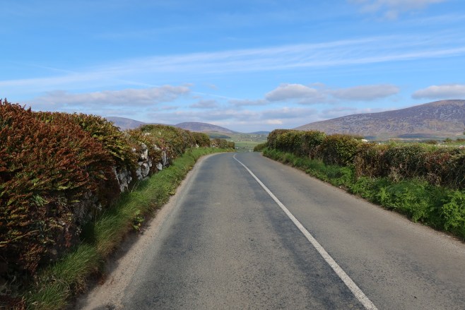
Traffic free narrow lanes make this route a smashing cycle route with a nice bit of climbs along the way to keep you honest… nothing major but a few nice pulls. And did I mention the scenery? Ah my God…
Traffic free laneways – just keep an eye out for the farm animals!
Or the hurlers? Down every by road are the famed Rangers and St Mullins camán wielders, territories marked out by red and black or green and white flags.. there must be great banter here around County Final time…
The more I cycle the more convinced I am that instead of investing millions in greenways, we should concentrate instead on creating dedicated cycle routes using the extensive local road network that links our isolated villages and parishes. It would cost an awful lot less and would not entail further damage to our biodiversity or result in the creation of more hard surfaces than we need.
Not a drop of milk in any of them…Roads full of promise And the Lamb did follow her!Gowlin