Rathanna Cycle Hub ?
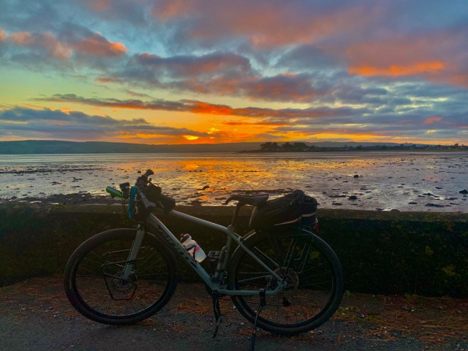
Looking for a place to plan some nice cycle routes from? The tiny village of Rathanna would make a great cycle hub for south Carlow, south east Kilkenny and Wexford around the Blackstairs. Located between Borris and the Blackstairs Rathanna is perfectly positioned for exploring the Blackstairs Mountains, using tiny traffic free local roads, where time seems to stand still.

Equip yourself with the absolutely brilliant ‘Blackstairs, Mount Leinster & The Barrow Valley’ map produced by East West Mapping (they are based in Clonegal, and produce a series of maps ideal for hiking and cycling activities) and you will have the complete picture to create a multitude of scenic and historically interesting routes that will have you coming back for more.
The history of Ireland and all our local communities is bound up in the richness of our original Irish place names. Every townland, hill and river has a name that tells a story – it might relate to the landscape, to the people who lived there, historical events or ancient mythology. This part of Carlow is rich in heritage. The place names reveal long forgotten aspects of our past – monasteries, churches, battle sites, folklore… they still live on and these connect us with our past despite the angliscation of our country which deliberately mistranslated their original meaning. That’s a pet hate of mine; I hate to see modern housing estates adopting typically English names such as … Tudor Downs or other such pretentious nonsense, when we have so many meaningful options in our original names and heritage to choose from.
In an era of rapid globalisation, preserving local placenames helps maintain a connection to the past. They are not just markers on a map; they are living records of the Irish language, our history, and our identity. For those interested in genealogy, researching placenames can reveal ancestral links and provide a deeper understanding of family roots.
And economically, for tourism and cultural heritage, the meanings behind placenames can enhance visitors’ appreciation of the landscape. Many tourists are fascinated by the poetic and descriptive nature of Irish placenames, which add depth to the country’s storytelling tradition. This quiet part of Carlow has its own unique charms, just waiting to be explored.

This is a great route with plenty of climbing featuring breath taking scenery and a magnificent narrow strip of tarmac with a huge drop down the mountain side if you get too distracted by the views! I started out at the car park opposite St Fortcherns Church in Rathanna and beside Osbornes tiny pub (which also has a hostel attached), it’s a gentle start, gliding downhill to Jack Carrolls bridge over the Killedmond river and on to the ‘Bull Ring – a unique little pentagonal piece of ground shaped by the surrounding network of roads and from where the climb starts to gently rise. It rapidly becomes very steep approaching Tomduff Crossroads and the approach road to Mount Leinster. Use the excuse of taking in the views to take a break from the fairly savage gradient as you head up towards the famous Nine Stones and the Columbanus Bell which marks the starting point of Turas Columbanus, a pilgrimage route, linking Carlow and Bangor in County Down.

The Nine Stones is a very popular spot for Sunday drives and the short walk up Slievebawn or the more challenging road to the TV transmitter on top of Mount Leinster.

I was delighted to bump into Carlow’s finest dual player ever, Paddy Quirke, here at the Columbanus Bell; he was out with the family for some fresh air and a ramble. Naomh Eoin’s finest played Railway Cup with Leinster and was a dual All Star Replacement. He looks as fit as ever!

The views across the patchwork of green fields of County Carlow stretch out before you as far as the eye can see; it’s not a road for the feint hearted and it’s always important to be cautious when meeting a car as it can be quite daunting to an inexperienced driver. If the pace uphill to this point was tortoise like, the descent down past the Head of the River Burren was an adrenalin rush!

The source of the River Burren. I was once inspired by a tale of the great Gus Merne who walked from here to Carlow following the path of the Burren and I undertook it many years ago but didn’t quite get back to Carlow town by dark!
My favourite place name in Carlow is ‘Cúl na Sneachta’. Situated at the base of Mount Leinster, the road follows the contour of the hill around in a sweeping arc and I noticed a memorial stone I hadn’t seen before. I pulled hard on the brakes and made out the inscription s best I could and it said ‘Cathal Goulding’ but I couldn’t really make out the rest of it. I looked to up when I got home and it transpires it was erected in memory of Republican, Cathal Goulding (1923-1998) who was ‘Chief of Staff’ of the IRA and the ‘Officials’. I hadn’t heard of his connection with the area but he had spent a lot of time in his cottage at Raheenleigh. Following his death, he was cremated and his ashes were scattered at the Nine Stones. You learn something new every day!
A bit further on I turned back left in the direction of Rathanna at a cross roads, where there’s a famous piece of rock art on display in the garden of a house at the cross roads. From there I headed up onto what I dubbed ‘The Hidden Sky Road’ some years ago and which Carlow County Council signposted as a local cycling route. I love this road that skirts the western side of Tomduff, towering over Rathnageeragh Castle and the former National School. I don’t think I’ve ever encountered a car on this road – nor another bike either!


Now transformed!
It was another downhill by Seskinamadra – Seisceann na Madraí, the marsh of the dogs… where I swung right and stopped over to visit St Fortcherns Well and Killoughternane Church ruins.

Despite it association with miraculous cures, I wasn’t tempted to have a ‘cuppa’ but clearly, other brave souls do and if the presence of frogspawn is an indicator of clean water, then I’m sure it would have done me no harm at all! A famous chalice and patten were discovered here that date back to 1595; they were hidden during penal times. There’s great reading about the history of the well and the area in the Myshall and Drumphea parish website.
Killougternane Church is a beautiful example of an early ChristianChurch dating back to the 10th century. It’s a beautiful serene place to visit and the stone work is immaculate.


Also known as ‘The White Church’, this 10th century granite church is built on the remains of an earlier timber church founded by St Fortchen in the 5th Century. Local wisdom holds that Christianity was established here even before the arrival of St Patrick. Who knows for sure.. ‘Cill Uachtair Fhionáin’ meaning the ‘upper church of Finnian’ highlights its connection with St Finnian of Clonard (but really of Myshall!), one of the greatest monastic sites in the country where the ‘Irish Apostles’ were all educated.
I skirted around by Knocksquire and traced my way back to Rathanna via Killedmond after a terrific afternoon cycle, sightseeing and exploring our local heritage. Good to be able to do it!